Volcán Pacaya
Diary:
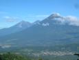
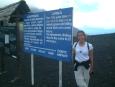
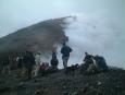
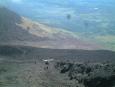
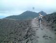
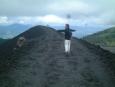
6am excursion to Volcán Pacaya, a few kilometers from Guatemala City. It was a 1.5 hour drive each way, and the climb up was 2 hours. Total vertical hiked was 580m, the smoking summit of the cinder cone was at 2576m. What a view!
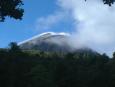
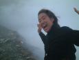
It was seriously windy on the summit, and since we were at about the same height as the clouds, the incredible views were obscurred each time a cloud mass enveloped us in a moist and cold fog. There was too much water vapor and smoke turbulence at the crater lip to see anything inside, but there was plenty of sulphur dioxide to choke on and the rocks on the ground underneath us were radiating a significant level of heat!
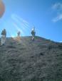
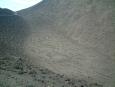
Still classified as an active volcano, Pacaya last errupted quite spectacularly two years ago. Of course we were very lucky it did not decide to do anything while we were perched on its rim; we would have been complete toast. Coming down the endless 45 ° scree slope was much more fun than going up! It was like water skiing or surfing down an endless wave made of tiny pumice stones and dust.
All up, a great hike: not too strenuous, and well recommended.
Photos: (click on images to see full size)
 |  |  |  |  |  |
 |  |  |  |  |