Kraków, Poland

Latitude 50.05251°N Longitude 19.94373°E

Wednesday, December 17, 2003

start of trip previous entry back to world map next entry end of trip

Diary:

Coming soon


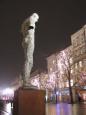
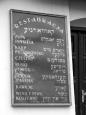
Photos: (click on images to see full size)

At the Florian Gate, the remains of the defensive wall around the Old TownScene in the Old Town on Florianska streetStatue in the magnificent medieval town square, Rynek GlównyRynek Glówny - the largest medieval town square in EuropeStatue in the magnificent medieval town square, Rynek GlównyStatue in the magnificent medieval town square, Rynek Glówny
Statue in the magnificent medieval town square, Rynek GlównyStreet sign in Podgórze, site of former Jewish ghetto in KrakówPolish post boxRestaurant sign, Kazimierz (old Jewish Quarter)Street scene, Kazimierz (old Jewish Quarter)Oskar Schindler's (of Schindler's List) factory


start of trip previous entry back to world map next entry end of trip

Email us!

Images and text © 2002-2023 NicoAndKeiko.com
All rights reserved
Reproduction in whole or in part without permission is prohibited